Above , the British company that combines drones, specialized software and artificial intelligence (AI) to monitor and optimize solar plants, is launching at PVBook with a technological offering aimed at revolutionizing the operation and maintenance (O&M) tasks of the sector.
With over 50 GW monitored in large-scale projects, 54 countries reached and over 80,000 hectares mapped , Above positions itself as one of the leading companies in solar digitalization.
Their presence on the platform aims to bring their technology closer to new players in the Latin American and global market, with a focus on developers, EPCs, asset managers and technical operators.
The company's proposal covers all phases of a solar project: from initial topography and construction monitoring, to O&M inspections using aerial thermography and visual analysis.

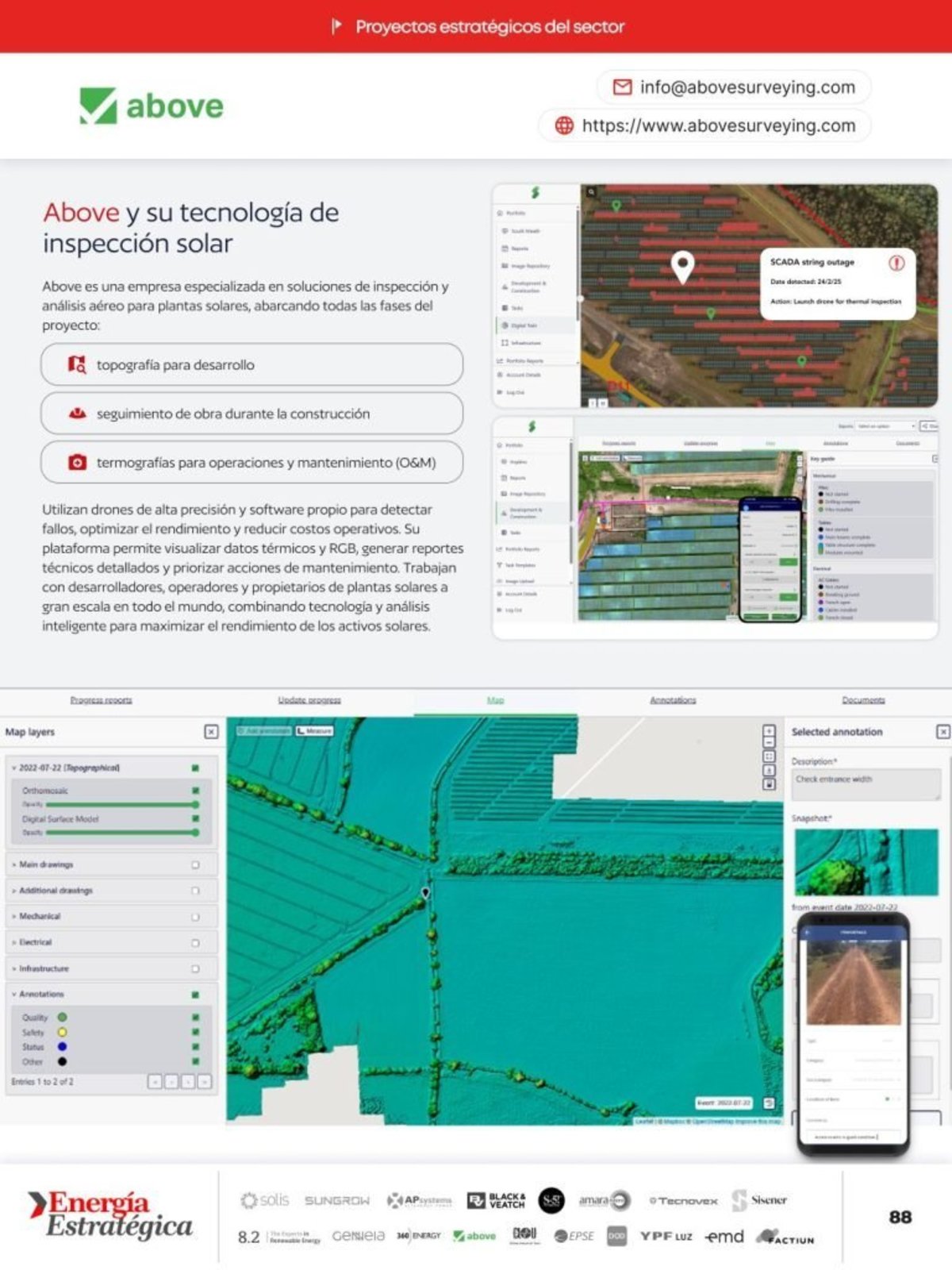
Using high-precision drones, the company captures RGB and thermal data which it then processes on its digital platform.
And through the SolarGain system, users can view maps, reports and detected deviations, with an accuracy of up to 3 centimeters relative to the original layout.
One of the most valued features is the automation of progress control , with reports that indicate precise percentages per milestone, from module installation to trench laying.
This system allows for improved negotiations of payment milestones with contractors and reduces the margin of error by 10% to 15% compared to traditional reports.
"Each flight generates data that is converted into graphs and reports ready for decision-making," said Adrián Cruz Castro , senior technical account manager for LATAM and Southern Europe, during Above's Day , organized by Energía Estratégica .
Additionally, Above incorporates 360° panoramic images, useful for observing roads, vegetation or power lines before the start of construction.
"It's very useful for first visits or for the EPC contractor," Cruz Castro emphasized, referring to those responsible for engineering, procurement, and construction of solar projects.
This entire ecosystem is structured through the SolarGain platform, a digital environment that centralizes the georeferenced information of each component of the project: modules, inverters, transformers, wiring, fencing and more.
The application allows you to scan serial numbers, record non-conformities in the field, and eliminate the use of paper.
"We want to ensure that operations can do more with less," Cruz Castro said.
The company adapts the frequency of flights according to the type of project and the client's needs: they can be monthly, weekly or at critical points in the construction schedule.
"We adapt to the schedule and the needs of the terrain."
If there is vegetation, we use LiDAR; if not, we apply photogrammetry, explained Alejandro Cebrián García , sales manager for LATAM and Southern Europe.
The model proposed by Above is geared towards a future where technicians can concentrate on quality management, while the system and its algorithms take care of the continuous monitoring of each component.
With its inclusion in PVBook , Above joins an ecosystem of innovative companies that are transforming the development, monitoring and maintenance of large-scale solar assets.
Access the PVBook for free here.